
|
|
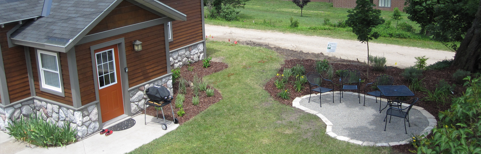
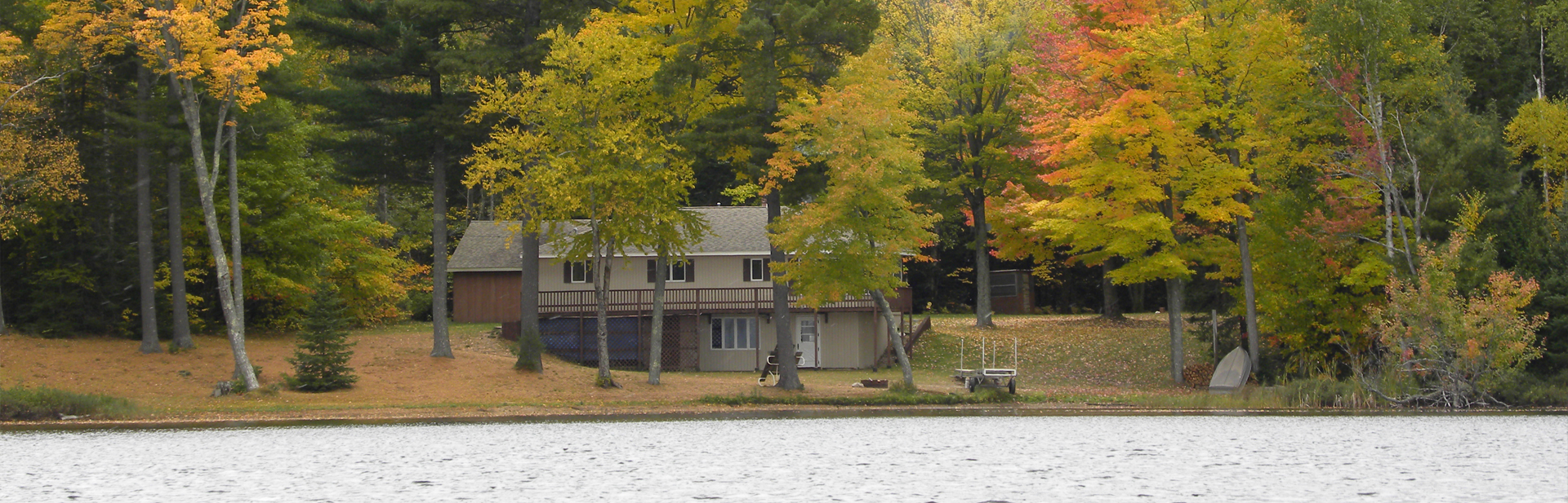
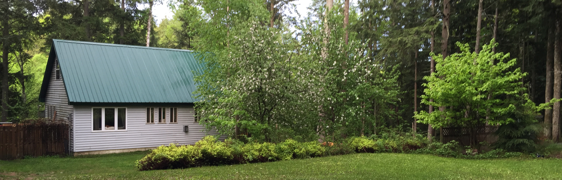
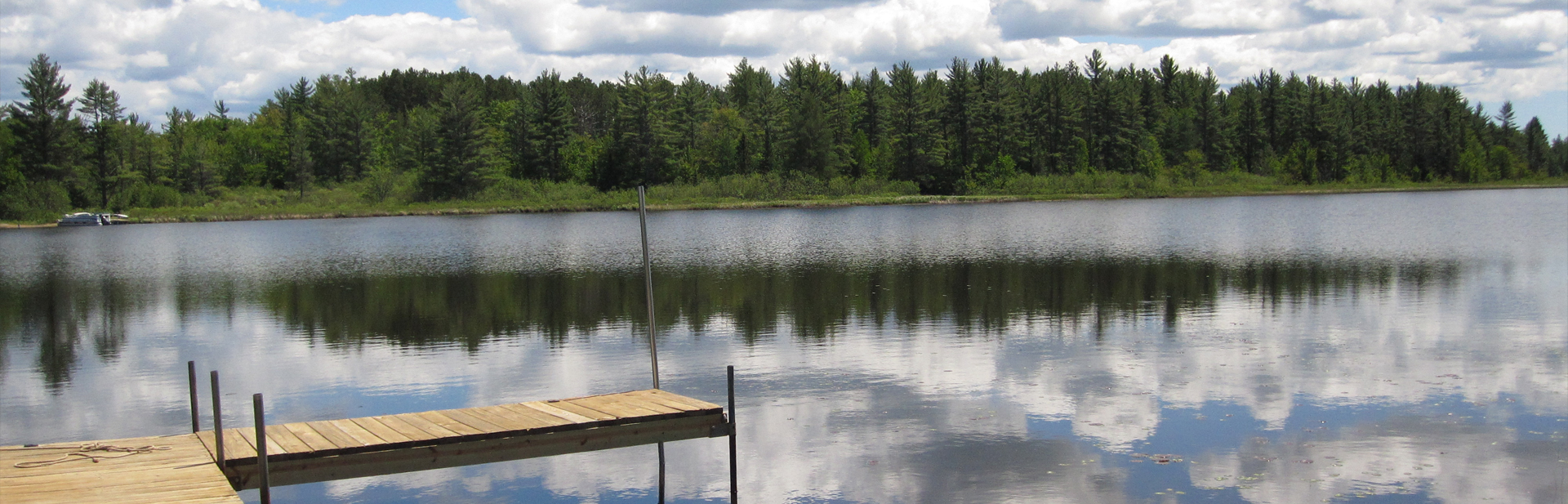
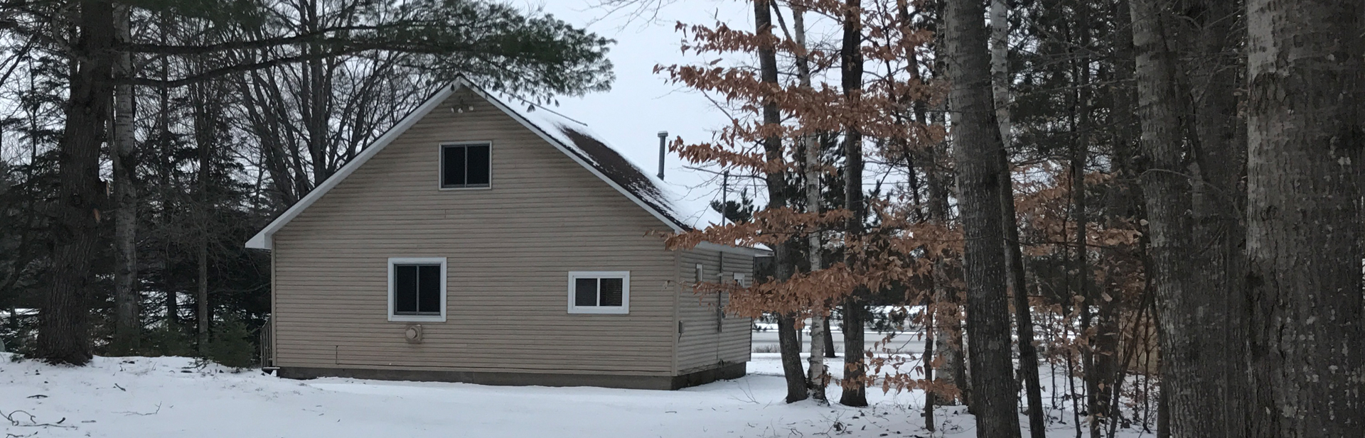
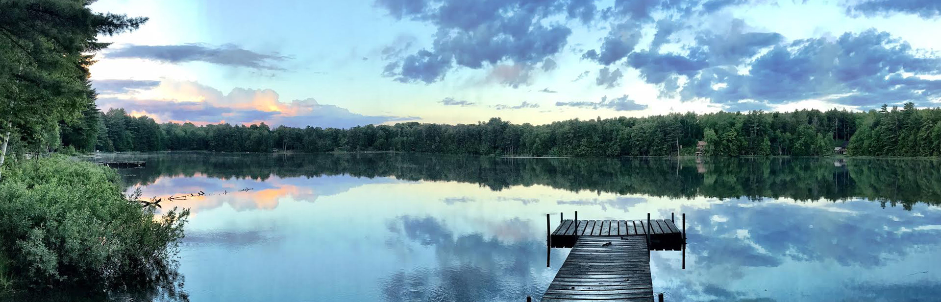
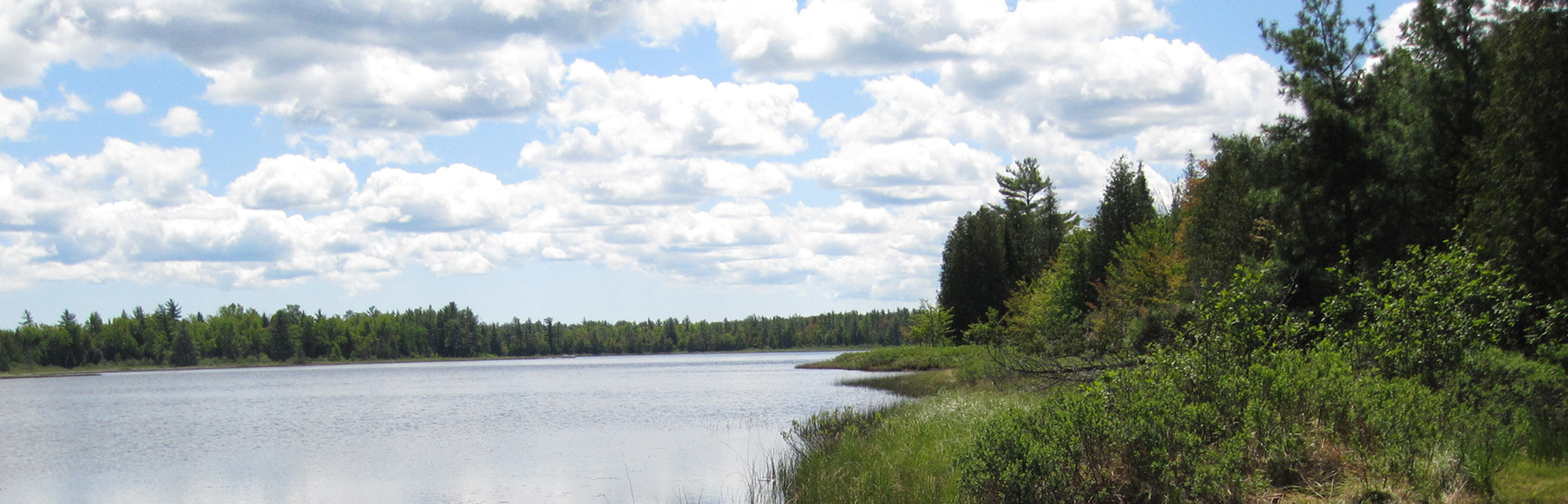
 Hiawatha's Vacation Homes
Munising, Michigan Attractions
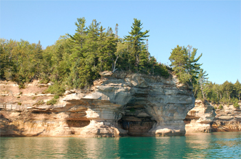
Pictured Rocks National Lakeshore
The Pictured Rocks National Lakeshore is America's first national lakeshore. Its name comes from the sandstone rock cliffs that are exposed along the lakeshore, known as the Pictured Rocks. The cliffs are most prominent along the shoreline of Lake Superior between Sand Point and Little Beaver Lake, a stretch of 15 miles. In some areas the cliffs rise some 200 feet above the lake.
The name "Pictured Rocks" is due to the pictures that seem to appear on the rocks from the multicolored sandstone and mineral stains on the rock surface. The cliffs are composed of Cambrian Sandstone, dating back about 500 million years. The stains on the sandstone are caused by water running down the cliffs filled with oxides of copper, manganese, iron, and organic minerals.
 To get the best view of the rocks from land you should visit the overlooks at Miners Castle, the east end of Miners Beach, and the Lakeshore Trail that runs the length of the park. If you like to hike you will enjoy the nine mile Chapel Loop trail. This Trail offers views from the highest points of the cliffs. If you do plan to hike atop the cliffs use caution. The Cliffs are soft sandstone some reaching heights of 200' which pose as a danger especially if the cliffs are undercut by erosion, so Stay Back From The Cliff Edge.
Whether your visit to the Pictured Rocks Lakeshore lasts only an hour or if you stay for a week or two, you might want to begin your visit at one of the visitor centers located in Munising and Grand Marais. Here you can pick up numerous amounts of brochures and any additional information you need to make your visit outstanding.
 Munising Michigan Attractions
We invites you to experience our unique Munising, MI attractions. Below we have provided you with a detailed list of our area points of interest.
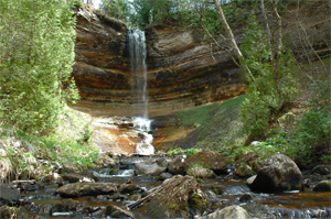
Munising Falls: The 50 foot falls are nestled in a cool and shady valley at the end of a short hike along a very well maintained trail. The water from the falls once aided in the production of iron at the Schoolcraft blast furnace.
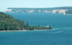
Sand Point: This is a popular area for bird watching as well as swimming or walking along the beach. The Point Marsh Trail, a half-mile fully accessible interpretive trail provides access to a unique wetland environment. You can enjoy maritime history exhibits near the old Munising Coast Guard Station where Park Headquarters are located.
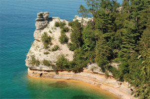 Miners Castle: A fully accessible trail leads from a beautifully constructed picnic area past breathtaking views of Grand Island and Lake Superior, down to an overlook platform directly above the Castle. Erosion over long periods of time have formed the shape of a castle in the sandstone cliffs. At one time you were able to walk atop the castle but due to the mass erosion you must now stay on the platform. (See picture above)
Miners Beach: This beach which extends for one mile is a picnickers fantasy. The beach gives you a beautiful look at Lake Superior and is a great place for children to build sand castles, but watch out for those playful waves waiting to bring them down.
These are only a few of the many attractions located along the Lakeshore, in order to visit and enjoy all the wonderful attractions that Pictured Rocks offers you would need to spend a week or more in the area. The best way to see all of the Pictured Rocks is to take a cruise on the Pictured Rocks Boat Cruises, which began in the 1920's.
 Grand Island National Recreation Area
Grand Island is located in Lake Superior, about 1/2 mile from the mainland of Munising, Michigan & 43 miles from Marquette, Michigan. A National Recreation Area since 1989, Grand Island's natural beauty and history make it an attractive place to spend a day. Travel to and from the island by private watercraft or ferry service. The ferry departs from Grand Island Landing on the mainland during the Summer and early Fall. For more info, please call: 906-387-3503.
Hiking and Mountain Biking
Hiking and mountain biking trails provide wonderful opportunities for day trips and give access via unsurfaced trails to some of the Island's most spectacular scenery. Roads and trails on the island are currently maintained to low standards and some may have washouts, fallen trees, etc. When travelling to and from the Island, it is important to keep in mind the ferry schedule as you plan your time on the island. Note: the bridge across North Light Creek at the far north end of the island is washed out and is closed due to unsafe conditions. When hiking and biking on the island roads, please be aware that you must share some of the roads with vehicular traffic. Drinking water is not available on the island.
Fishing, Hunting, Trapping and Nature Watching
Day visitors may find a variety of ways to enjoy the island's wildlife. For anglers, Echo Lake offers bass, pike, and pan fish. Murray Bay has perch, pike, walleye, and rock bass. In Trout Bay, and all around the island, lake trout and coho salmon may be caught by trolling. Game species on the island include bear, deer, rabbit, grouse and duck. A Michigan fishing, hunting and/or trapping license is required.
Camping
Currently, there are six designated campsites on Grand Island: two at Murray Bay and four at Trout Bay. At each designated site, campers must set up their tents within 15 feet of the site marker post, and fires are allowed only in the metal fire ring provided. Fires are prohibited on the beach and outside of fire rings. Permits are not required for these campsites. Each campsite at Murray Bay can accommodate up to six people with a maximum of two tents per site. On Trout Bay, four campsites can accommodate up to four people each, with a maximum of two tents per site. Random camping is allowed on the island (with the exception of the tombolo).
Random sites must be more than 100 feet from:
Lake Superior or its cliff edge
Other campsites or recreation developments
Private property
Trails and roads
Inland lakes
Named creeks and
The Research Natural Area
If you like strolling along sandy beaches, taking a dip in clear refreshing water, biking atop 300 foot sandstone cliffs with a spectacular view of Pictured Rocks, or camping beneath a sky filled with stars, then Grand Island is the place for you.
If you need to catch a ride over to Grand Island, you can hop aboard the passenger ferry provided by the Grand Island Ferry Service. The ferry to Grand Island departs from the Grand Island Landing. The landing is located one mile west of the Munising City Limits.
Times are as follows
From Memorial Day Weekend to Oct. 9
9:00 a.m., noon, 3:30 p.m., and 6:30 p.m.
After Labor Day the 6:30 p.m. trip will be dropped.
For Ticket Information call (906) 387-3503
The Ferry will take a short trip around the Island where you can view historic sites of Native American settlements and you will also get a good look at the East Channel Lighthouse. Through the viewing well on the ferry you will be able to get an awesome view of the Bermuda ship wreck.
Once on the Island you can jump aboard the ALTRAN bus for a breathtaking tour of the Island. The tour lasts about 2 1/2 hours. The buses are wheelchair accessible but the trails on the island are sandy and uneven. There are no toilets on the tour route.
Hiking and mountain biking are popular day time activities along the island's open travel ways, but you must be aware that some roads are shared with motor vehicles. If you plan on bringing a dog it must be on a leash at all times except when hunting. There is a site on Murray Bay that is designated for picnicking and sightseeing no camping is aloud on this site.
There are six designated camping sites on Grand Island; two at Murray Bay, and four at Trout Bay. At each site your tent must be within 15 feet of the camp site marker post. All fires must be contained within the metal fire ring provided. Visitors must not build fires on the beaches or outside the fire rings. Permits are not required at this time for these sites. The sites located at Murray's Bay have a size limit of six campers per site and a max of two tents per site. The sites on Trout Bay have a limit of four campers and two tents per site. Random camping outside these sites are permitted but camp fires are not allowed at your site. Random sites must be 100 feet from Lake Superior and its cliffs, other campsites, private property, trails, inland lakes, named creeks, and the Research Natural Area (RNA).
 Hiawatha National Forest
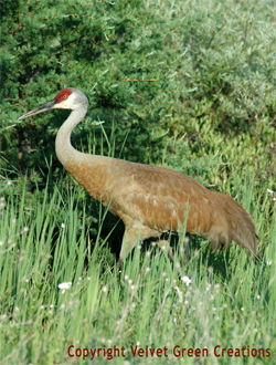
The Hiawatha National Forest is a popular recreation area with outdoor activities year round. These activities include rustic camping, picnicking, boating/fishing, swimming, canoeing, mountain biking and hiking along the many recreational trails that connect campgrounds and historic sites. Hiawatha National Forest has unique plants and animals, that include threatened and endangered species. It has managed the habitat of the greater sand hill crane for years and is monitoring the lake sturgeon which is also a threatened species. The Forest has also reintroduced the pine marten within its boundaries.
Hiawatha National Forest is surrounded by three of the Great Lakes. Located within its boundaries are two Great Lakes islands, Round Island and Government Island. This makes Hiawatha National Forest one of the most unique of the four National Forests within Michigan's two peninsulas.
Lighthouses in Hiawatha
Located within the Hiawatha National Forest are three historic lighthouses. The Point Iroquois Lighthouse located at White Fish Bay on Lake Superior, Round Island Lighthouse located near Mackinac Island in the Straits of Mackinac, and the Point Peninsula Lighthouse located at the tip of the Stonington Peninsula on Lake Michigan.
Recreational Trails in Hiawatha
The trails within the Hiawatha National forest are popular to a variety of different users. The Bay de Noc-Grand Island Trail offers 40 miles of scenic routes for horseback, hiking and cross-country skiing. Valley Spur and the Rapid River Cross-Country Ski Trails are popular routes during the winter, they offer a challenge no matter what experience level your at. Some of the North country National Scenic Trail also passes through the Hiawatha National Forest.
For more information on Hiawatha National Forest call or write to:
Forest Service/Park Service
Route 2, Box 400, Munising, MI 49862
(906)387-3700
![]() For more beautiful Munising, Michigan area photos of attractions, activities and great vacation photos, please click on the learn more button.
For more beautiful Munising, Michigan area photos of attractions, activities and great vacation photos, please click on the learn more button.


Copyright ©2010 - 2024 Hiawatha's Hideway, LLC - Vacation Homes. All rights reserved.